-
GAF AG und BKG intensivieren ihre Kooperation im Hinblick auf die Bereitstellung von Multi-Source-Fernerkundungsdaten
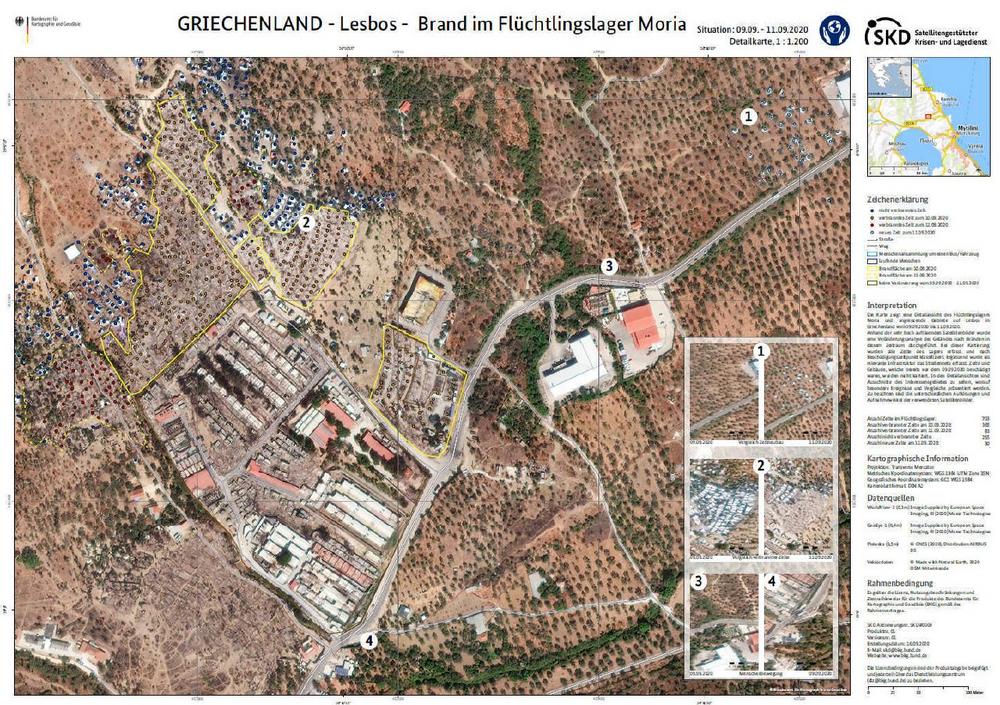
Die GAF AG, einer der größten europäischen Anbieter von Geoinformationsdiensten mit dem Schwerpunkt Erdbeobachtung, hat eine internationale Ausschreibung des Bundesamts für Kartographie und Geodäsie (BKG) für die Bereitstellung von Fernerkundungsdaten gewonnen. Der daraufhin abgeschlossene Rahmenvertrag beinhaltet Beratungsdienstleistungen und Exklusivzugriff für das BKG und deren Bedarfsträger auf hochauflösende und sehr hochauflösende optische Satellitenbilder sowie Radaraufnahmen. Mit dem Satellitengestützte Krisen- und Lagedienst (SKD) leistet das BKG einen unverzichtbaren Beitrag, unkompliziert und schnell aufbereitete Informationsprodukte aus Geodaten und Fernerkundung an alle Bundeseinrichtungen bereitzustellen. Bei sicherheitsrelevanten und kritischen Herausforderungen ermöglicht dies eine schnelle Reaktion. Dr. Sebastian Carl, CEO der GAF, hebt hervor: "Wir freuen uns sehr über die Intensivierung der Zusammenarbeit. Die GAF kann…
-
GAF AG and BKG intensify their cooperation regarding the provision of multi-source remote sensing data
GAF AG, one of the largest European providers of geographic information services with a focus on earth observation, has won an international tendering process issued by the German Federal Agency for Cartography and Geodesy (BKG) for the provision of remote sensing data. The framework agreement concluded on that basis includes consulting services and the granting of exclusive access to the BKG and its users to high-resolution and very high-resolution optical satellite images and radar images. With its satellite-based crisis and situation service, the BKG makes an indispensable contribution to providing straightforward and rapidly-prepared information products derived from geodata and remote sensing to all the federal institutions. This enables a rapid…