MBI Global Boundaries Release 2026 for Advanced Location Intelligence
A Comprehensive Global Dataset for GIS Workflows
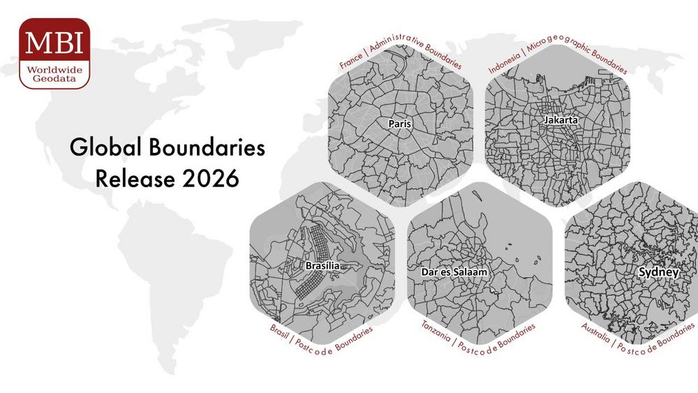
The Global Boundaries dataset covers 248 countries worldwide and includes a wide range of geographic layers, from administrative units to postcode boundaries and microgeographic structures. This breadth of coverage allows users to work across markets with a consistent data foundation, reducing the complexity often associated with international analysis.
A key strength of the dataset lies in its flexibility. It is available in multiple industry-standard formats such as ESRI Shapefile, GeoDatabase, GeoJSON, and GeoPackage, ensuring compatibility with virtually all GIS platforms and data environments. This makes it easy for organizations to integrate the data into existing workflows without the need for extensive preprocessing.
Enabling Better Decisions Through Spatial Analysis
At the core, Global Boundaries are designed to turn geographic data into actionable insight. By linking business data such as sales figures, customer locations, or operational metrics to precise geographic boundaries, organizations can visualize patterns that would otherwise remain hidden in spreadsheets.
This capability is particularly valuable in areas such as market analysis, site selection, and resource allocation. Instead of relying on broad regional averages, companies can drill down into highly specific geographic units, enabling more accurate targeting and more informed decision-making.
The result is not just better maps, but better strategies.
High Granularity Across Key Global Markets
One of the defining features of the 2026 release is its level of detail. MBI provides access to more than 2,000 geographic levels globally, allowing users to analyze data at a depth that matches their specific use case.
This level of precision enables organizations to move beyond country-level or regional analysis and instead focus on the local dynamics that often drive real business outcomes.
Data Quality You Can Rely On
One of the major challenges in global datasets is inconsistency between countries and levels. MBI addresses this by applying a unified data process across all geographies, avoiding the fragmentation often seen in aggregated or third-party compiled datasets.
MBI Global Boundaries are built through a controlled production process that prioritizes accuracy, consistency, and long-term maintainability. Each dataset undergoes:
- Standardization across countries and levels
- Topology validation and gap-free coverage
- Attribute harmonization for cross-border comparability
- Continuous updates aligned with official statistical and administrative sources
A key advantage of MBI Global Boundaries is its 1:1 compatibility with MBI Global Market Data, enabling users to seamlessly combine geographic boundaries with detailed demographic and market data. This unique integration allows for immediate, analysis-ready workflows without the need for complex data matching or reconciliation.
This ensures that users are not just working with data, but with a reliable geographic framework that supports enterprise-grade decision-making.
A Foundational Layer for Location Intelligence
MBI Global Boundaries are not just a dataset, they act as a standardized geographic backbone for organizations operating across multiple markets. Whether in retail, logistics, telecommunications, or finance, location intelligence plays a critical role in understanding markets and optimizing operations. By ensuring consistency across countries and levels, MBI removes one of the biggest barriers in global analytics: incompatible geographic structures.
Retailers can use the data to refine store network planning, while logistics providers benefit from improved route optimization and delivery efficiency. In finance and insurance, geographic segmentation supports more accurate risk assessment and helps identify new growth opportunities. Detailed boundary data also plays an important role in healthcare and public sector planning, enabling better service distribution and infrastructure development.
“Most organisations underestimate how much poor geographic data limits their analysis. What we provide with Global Boundaries 2026 is a consistent, high-resolution geographic framework that removes that limitation and allows teams to work with confidence across markets” says Ray Roberts-York, Managing Director at MBI.
This versatility makes the dataset a valuable foundation for any organization working with spatial data. Organizations interested in leveraging the MBI Digital Boundaries dataset can request further information on available geographic levels, regional packages, and integration options from our Sales Team.
MBI Geodata – globally consistent and comparable
Being a specialist for small-scale data for Geomarketing, Michael Bauer International has grown to one of the largest global data providers for over 15 years. MBI unites passion and scientific know-how to provide globally consistent and comparable geographic, market and risk data.
Today MBI is not only recognized as a key data source but is also the preferred data provider for the largest leading GIS software and technology companies globally. For a vast variety of companies, MBI’s data is the foundation for location-based questions related to company locations as well as branch and distribution networks. MBI mobile data offers valuable insights into the global consumer behavior and their customer journey. Companies from all industries are supplied with up-to-date data for market analyses and visualization by MBI, to take informed and data-based decisions.
With CONIAS Risk Intelligence, we provide in-depth and data-driven information about the current and emerging dynamics of political conflicts worldwide. We support internationally operating companies and organizations in identifying political risks to location, logistics and investment security at an early stage and in developing targeted adaptation strategies.
MBI is one of the first global HERE Technologies Distributors as well as “Global HERE Distributor of the Year 2023”. HERE is the leading provider in the development of digital maps and location-based services.
Both Michael Bauer Research GmbH and Michael Bauer Micromarketing GmbH are part of the Michael Bauer Group.
For more information, please visit www.mbi-geodata.com.
Michael Bauer International GmbH
Greschbachstr. 12
76229 Karlsruhe
Telefon: +49 (721) 1618566
Telefax: +49 (721) 94540496
http://www.mbi-geodata.de
Head of Marketing
Telefon: +49 (721) 46470339
E-Mail: jessica.dammert@mbi-geodata.com
![]()