-
GeoCue and Argosdyne Announce Partnership to Expand Drone Mapping Solutions in East Asia
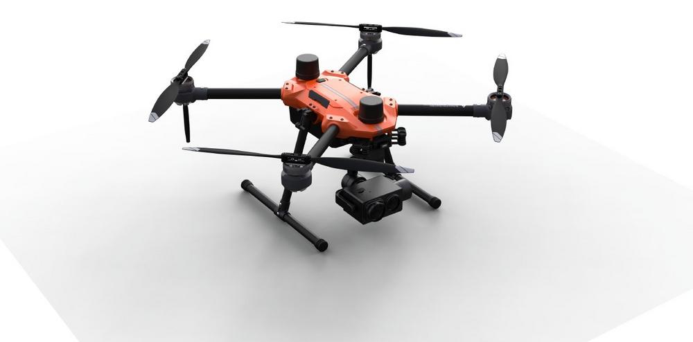
GeoCue, a leader in LiDAR mapping hardware & software solutions, announces its expansion into East Asia through a strategic partnership with Argosdyne, a prominent drone manufacturer and supplier. This collaboration will strengthen GeoCue’s global distribution network and enable Argosdyne to offer TrueView 3D Imaging Sensors and LP360 LiDAR Processing Software to customers in South Korea and throughout East Asia. Argosdyne, established in 2018, has quickly emerged as a key player in the drone industry, specializing in the manufacturing of drones and docking systems. With a diverse clientele and successful partnerships with organizations such as Samsung Electronics Factory, Hyundai Motors, and Hyundai E&C, Argosdyne has demonstrated its commitment to delivering high-quality…
-
GeoCue poursuit sa croissance européenne avec l’ajout d’HEXADRONE en tant que distributeur français
GeoCue, leader des solutions matérielles et logicielles de cartographie LiDAR, annonce la nomination de HEXADRONE en tant que son nouveau distributeur en France.. HEXADRONE, PME industrielle spécialisée dans la vente de drones et le développement mécatronique, rejoindra le réseau mondial de distribution de GeoCue afin de fournir les capteurs d’imagerie 3D TrueViewet le logiciel de traitement LiDAR LP360 à des clients en France et en Europe. HEXADRONE, en activité depuis 2014, est spécialisée dans la vente et le service de drones et d’accessoires multimarques, ainsi que dans le développement mécatronique pour la fabrication, la maintenance et la formation de drones. Avec une équipe de vingt experts située dans une usine…
-
GeoCue Continues European Growth with the Addition of HEXADRONE as French Distributor
GeoCue, a leader in LiDAR mapping hardware and software solutions, announces the appointment of HEXADRONE as its newest distributor in France. HEXADRONE, an industrial SME specializing in drone sales and mechatronic development, will join GeoCue’s global distribution network to provide TrueView 3D Imaging Sensors and LP360 LiDAR Processing Software to customers in France and Europe. HEXADRONE, in business since 2014, specializes in the sales and service of drones and multi-brand accessories, as well as mechatronic development for drone manufacturing, maintenance, and training. With a team of twenty experts located in a state-of-the-art 1,000 square meter factory in St Ferréol d’Auroure, HEXADRONE is known for its innovative solutions and commitment to…
-
GeoCue étend sa présence en Europe avec un nouveau distributeur français, Escadrone
GeoCue, l’un des principaux fournisseurs de solutions logicielles et matérielles géospatiales avancées, a le plaisir d’annoncer l’incorporation de Escadrone dans son réseau mondial de distributeurs. Ce partenariat stratégique poursuit l’expansion de GeoCue sur le marché européen, en particulier en France et dans les pays francophones où Escadrone fournira les capteurs d’imagerie 3D TrueView et le logiciel de traitement LiDAR LP360. Escadrone, expert reconnu dans l’intégration de la robotique autonome pour les applications civiles professionnelles, est au service de ses clients depuis 2014. En. tant que pionnier dans la conception, la vente et l’approbation de la technologie des drones, ainsi que dans la fourniture d’une formation complète, Escadrone offre des solutions…
-
GeoCue Expands European Footprint with New French Distributor, Escadrone
GeoCue, a leading provider of advanced geospatial software and hardware solutions, is pleased to announce the addition of Escadrone to its global network of distributors. This strategic partnership continues to extend GeoCue’s expansion into the European market, particularly in France and French-speaking countries where Escadrone will provide advanced-level TrueView 3D Imaging Sensors and LP360 LiDAR Processing Software. Escadrone, a renowned expert in autonomous robotics integration for professional civilian applications, has been serving its customers since 2014. As a pioneer in the design, sale, and approval of drone technology, along with providing comprehensive training, Escadrone offers personalized autonomous robotics solutions to a growing number of companies. Their wide range of training,…
-
AlphaGeo Joins the GeoCue Global Network Expanding Access to TrueView LiDAR and LP360 Software in the United Kingdom
AlphaGeo UK, a reputable reseller of UAV’s UAV sensors, surveying equipment and software solutions, is pleased to announce its partnership with GeoCue as the latest distributor in the GeoCue global network. AlphaGeo UK will provide cutting-edge TrueView 3D Imaging Sensors and LP360 LiDAR Processing Software to customers throughout the United Kingdom. Since its establishment in 2015, AlphaGeo UK has served a diverse range of customers in various sectors, including Hazmat, Mining, AECO (Architecture, Engineering, Construction and Owner-operated), Forestry, Heritage, Disaster management, utilities, and Marine (Off and onshore). As a highly experienced and reputable reseller, AlphaGeo UK offers expertise in drones/UAVs, payloads, ROVs (underwater drones), survey equipment (both land and hydrographic),…
-
Two New Drone LiDAR/Imagery Systems from TrueView, Plus, 3D Accuracy Software add-on and Accuracy Star Hardware for LP360 Drone Software
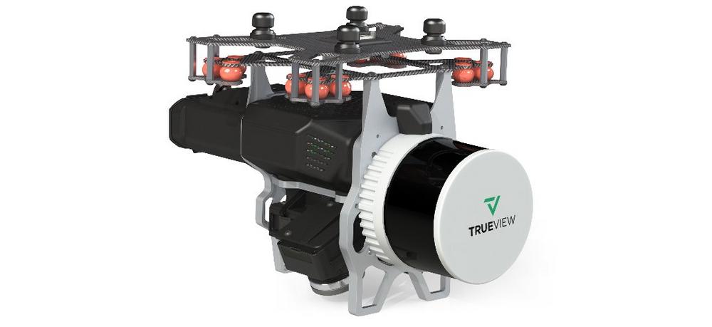
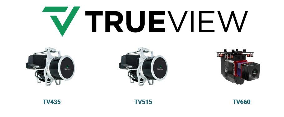
From the floor of Geo Week 2023, LiDAR mapping hardware & software company GeoCue announced new products for geospatial professionals. Frank Darmayan, CEO of GeoCue explains “Our new TrueView 535 builds upon the success of our best-selling TrueView 515 with several improvements; the upgraded LiDAR sensors adds a 3rd return which increases our ability to map below the canopy. The added 3rd nadir camera gives another critical point of view and improves photogrammetry quality.” He added, “With a longer useable LIDAR range and increase in track field of view, TrueView 535 gives our customers more flexibility in planning and flying their data collection projects. Lastly, we are introducing a new…
-
Les options de location de logiciels et de drone LiDAR de GeoCue sont désormais disponibles en Europe
GeoCue annonce le lancement européen du programme LiDARental 2023. Ce nouveau programme de location permet d’accéder facilement aux systèmes d’imagerie 3D innovants TrueView et au logiciel complet de traitement et de visualisation des données du drone LP360. Le drone LIDAR a consolidé sa position de technologie de pointe dans l’industrie géospatiale pour les applications d’arpentage et de cartographie. Cependant, pour les personnes qui ne connaissent pas le drone LiDAR, le coût du matériel LiDAR, du logiciel, du flux de travail, de la formation et de l’assistance peut être intimidant. Le programme LiDARental 2023 permet d’accéder facilement à l’arène des drones LIDAR/à l’imagerie. Le PDG de GeoCue, Frank Darmayan, explique : « Nous…
-
Der Drohnen-LiDAR- und -Software-Verleih von GeoCue steht jetzt auch in Europa zur Verfügung
GeoCue kündigt den europäischen Start des LiDARental-Programms 2023 an. Unser Abonnementmodell bietet einen einfachen und erschwinglichen Zugriff auf die innovativen 3D-Bildgebungssysteme TrueView und die vollständige Drohnen-Datenverarbeitungs- und Visualisierungssoftware LP360. Das Drohnen-LIDAR hat seine Position als führende Technologie in der Geodatenindustrie für Vermessungs- und Kartierungsanwendungen gefestigt. Die Kosten für LiDAR-Hardware, -Software, Arbeitsabläufe, Schulungen und Support können jedoch für manche Neulinge im Bereich Drohnen-LiDAR einschüchternd wirken. Das LiDARental-Programm 2023 bietet einfachen Zugang zum Drohnen-LIDAR/Bildbereich. Frank Darmayan, CEO von GeoCue, erklärt: „Wir wissen, dass viele Vermessungs-, Ingenieur- und Bauunternehmen gerne Drohnen-LiDAR einsetzen würden, aber aufgrund der Kosten, des Kundendienstes, der Software und der Anpassung zögern, diese Technologie einzuführen. Deshalb haben wir es mit…
-
Drone LiDAR and Software Rental Options from GeoCue Now Available in Europe
GeoCue announces the European launch of the 2023 LiDARental Program. This new rental program provides easy access to Innovative TrueView 3D Imaging Systems and the complete LP360 Drone data processing and visualization software. Drone LIDAR has solidified a position as leading technology in the geospatial industry for surveying and mapping applications. However, for some new to drone LiDAR, the cost of LiDAR hardware, software, workflow, training, and support can be intimidating. The 2023 LiDARental Program provides easy access to the drone LIDAR/ imagery arena. GeoCue CEO, Frank Darmayan explains, “We understand that many surveying, engineering, and construction companies are eager to implement drone LiDAR, but hesitant to adopt the technology…