-
GeoCue Expands in Poland: Geotronics Dystrybucja Joins European Distribution Network
GeoCue is proud to announce a new partnership with Geotronics Dystrybucja, one of Poland’s most experienced providers of geospatial solutions. Based in Kraków, Geotronics Dystrybucja officially joins the growing European distribution network for GeoCue, bringing TrueView 3D Imaging Sensors and LP360 software to professionals across Poland. Now available through Geotronics, customers throughout Poland can access the full lineup of TrueView LiDAR solutions, including the all-new TrueView GO handheld mapping scanner. From drone LiDAR to mobile and SLAM-based handheld sensors, GeoCue’s products offer cutting-edge tools for collecting and processing accurate, colorized point clouds and geospatial deliverables. Geotronics is also authorized to distribute LP360, GeoCue’s flagship LiDAR and photogrammetry software. LP360 enables…
-
GeoCue Announces New Drone Partnership with Clogworks Technologies
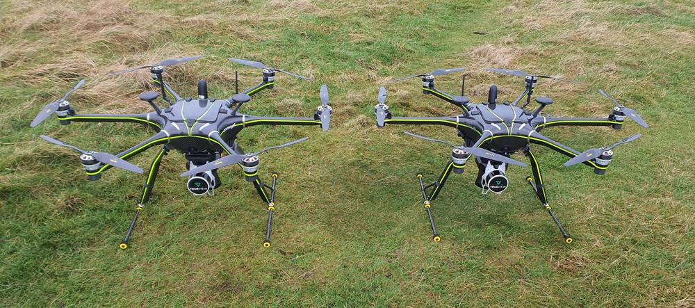
GeoCue, a global leader in LiDAR acquisition and data processing solutions, is pleased to announce a new strategic partnership with UK-based drone designer and manufacturer, Clogworks Technologies Limited. This partnership brings together GeoCue’s TrueView LiDAR and LP360 software solutions with Clogworks’ best-in-class Dark Matter range of multi-rotor UAVs, delivering a unique and highly efficient mapping and surveying solution to professionals around the world. Clogworks Technologies, founded in 2014 in Yorkshire, UK, specializes in delivering modular and adaptable carbon fiber drones that excel in challenging and complex environments. The partnership with GeoCue positions Clogworks to offer its customers advanced LiDAR scanning technology along with LP360—an industry-leading data processing software that offers…
-
LETEL Gains the Aerial Advantage with Drone LiDAR Technology from GeoCue
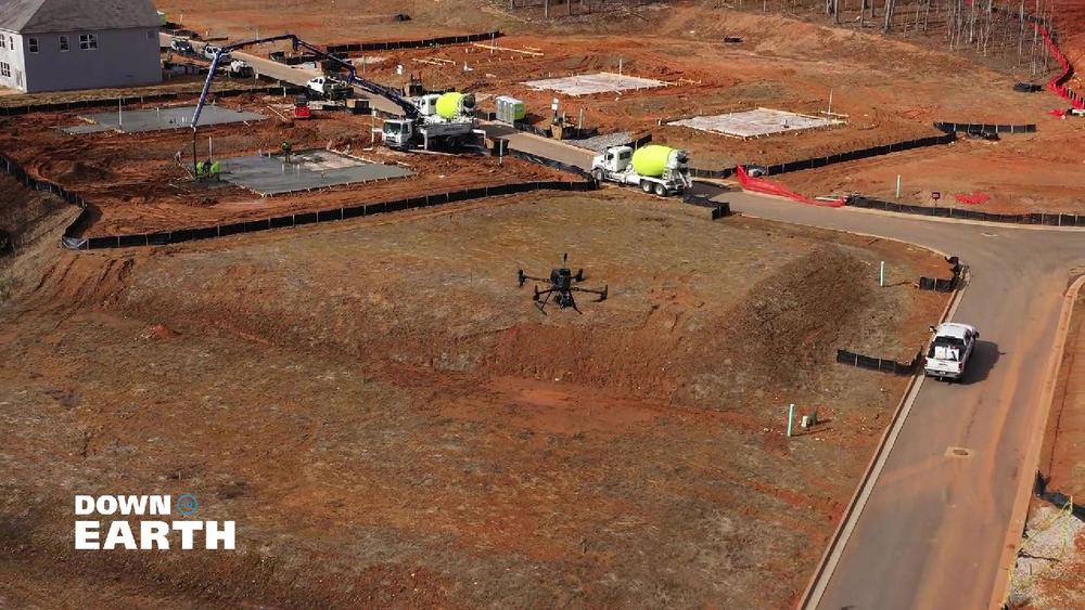
GeoCue, announces the premiere of the latest episodes of its award-winning drone surveying reality series, Down to Earth. The new episodes highlight LETEL, a leader in civil engineering, drone technology, LiDAR, and construction services, and their innovative use of TrueView LiDAR technology and LP360 software to overcome complex surveying challenges in construction services and land development. Before starting LETEL, John Downing began his journey in the construction industry digging ditches and getting his boots muddy. Determined to rise above, John embraced cutting-edge technology and invested in drones, a decision that transformed his career and led to the creation of LETEL. Now, with over 20 years of experience, John has grown…
-
GeoCue and CHC Navigation Join Forces to Unveil an Exclusive LiDAR Innovation with the New TrueView 540
Geo Week 2024, Denver, CO. – GeoCue, a leading geospatial hardware and software provider, and CHC Navigation, a pioneer in precision positioning solutions, proudly announce the launch of the TrueView 540. This innovative collaboration brings forth a new efficient and flexible survey-grade LiDAR system to North America, introducing an unparalleled combination of the LiDAR payload with LP360 3D Point Cloud Processing Software. TrueView 540 is a next-generation intelligent aerial surveying system developed by CHC Navigation, available through GeoCue. This next generation of intelligent aerial surveying is the result of six years of innovation and three years of meticulous product development, harnessing the power of CHCNAV’s state-of-the-art LiDAR technology. The TrueView…
-
GeoCue Announces Three New TrueView 3D Imaging Systems and Introduces FLEX Pricing Model at Geo Week 2024
GeoCue, a pioneer in geospatial hardware and software solutions, has set the stage for a groundbreaking year with the introduction of three new TrueView LiDAR Systems and an innovative FLEX pricing plan. This strategic move not only solidifies GeoCue’s position as a market leader but also addresses the increasing demand for comprehensive drone mapping hardware. The newly launched TrueView 3D Imaging systems include the TrueView 540, the TrueView 545, and the TrueView 585, each catering to distinct market needs. To complement these additions, GeoCue is also introducing the innovative FLEX pricing options on flagship models TrueView 515 and 535 payloads. TrueView 540: Expanding High-End LiDAR Technology with Competitive Pricing In…
-
Wingtra LIDAR is now supported by LP360!
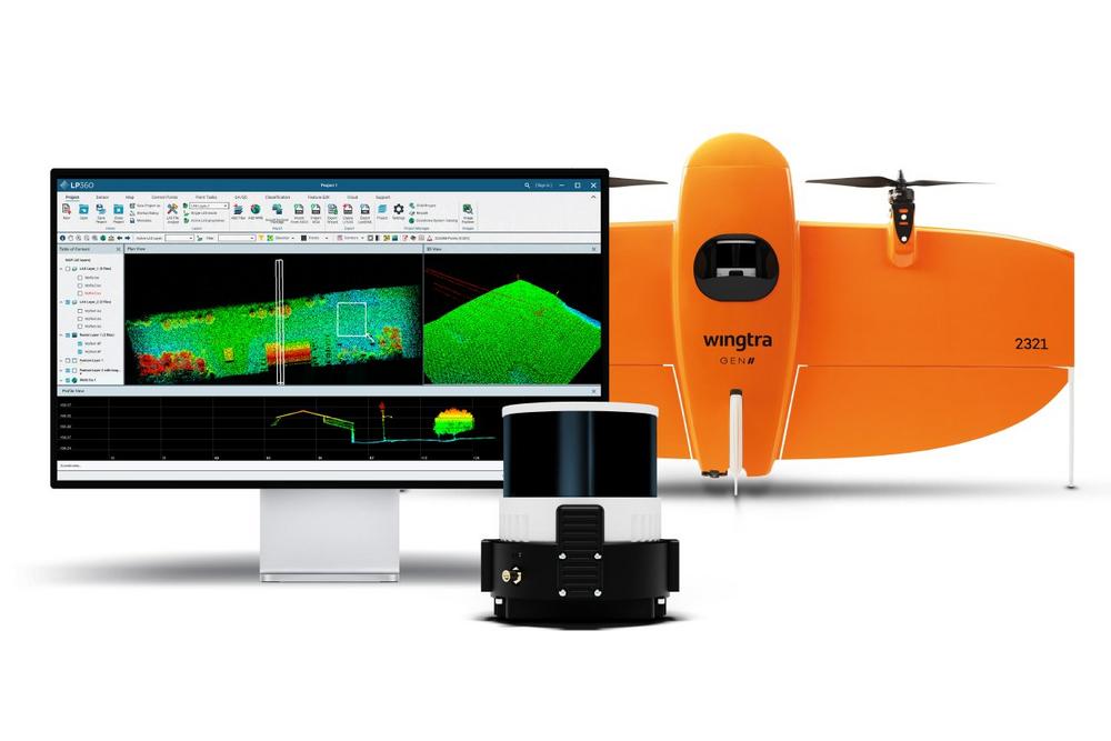
In conjunction with Wingtra’s latest product launch from Geo Week 2024, Wingtra LIDAR, GeoCue is pleased to announce the compatibility of LP360 Drone with the new sensor. As a guest sensor in LP360 Drone, Wingtra users gain the capability to effortlessly import and process their data into LP360 Drone for classification, DEM generation, transmission modeling, volumetrics, cross sections, CAD preparation, and other critical analyses. Geospatial professionals utilizing the new Wingtra LIDAR system will now have access to an extensive toolbox of geospatial tools within LP360 Drone. The software enables users to create point clouds from UAV raw data, transform, and quality control data collected with the new Wingtra LiDAR system.…
-
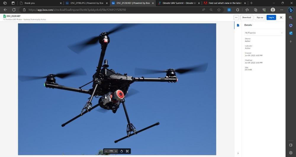
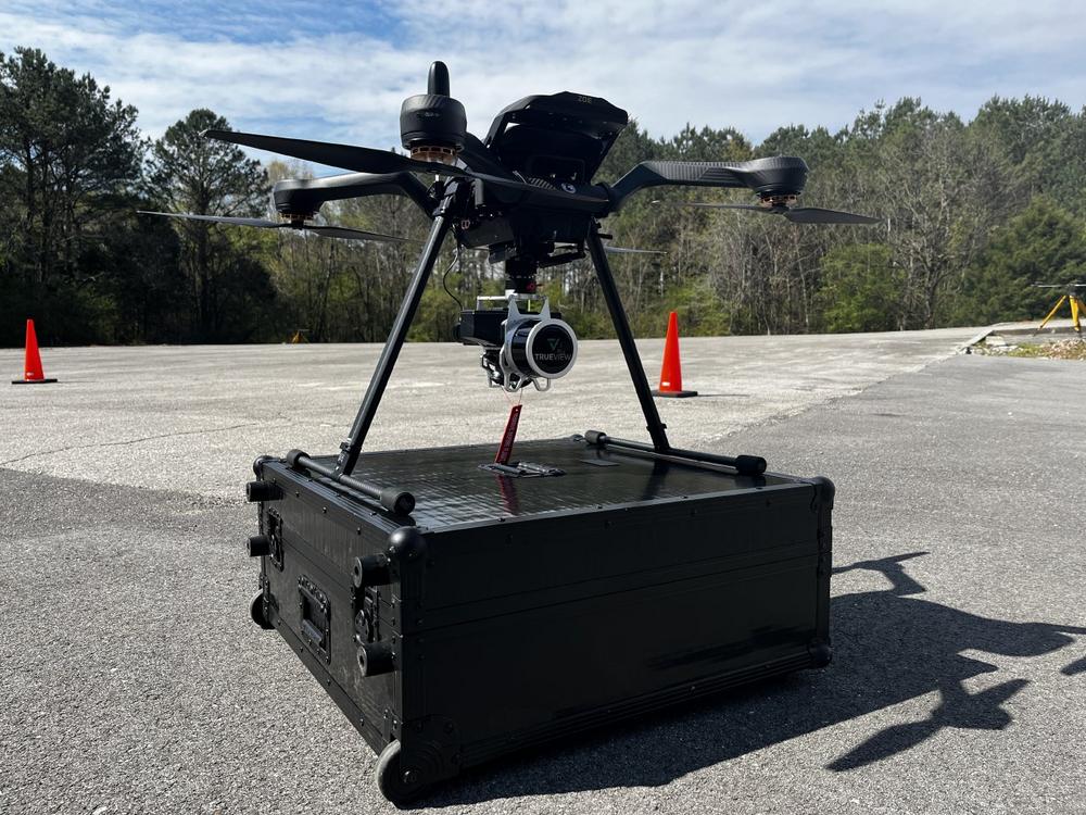
GeoCue Announces Dual Purpose Drone LiDAR and Mobile Mapping System Options
From the floor of The Commercial UAV Expo, Vivien Heriard Dubreuil, CEO of mdGroup (parent company of GeoCue) recounts a demonstration. “The new TrueView 680 LiDAR and 3D Imaging Payload attached to a heavy payload drone, touched down in the testing area collecting aerial data of the GeoCue headquarters. A drone pilot approaches the system, quickly removes the sensor from its quick release, and hands it off to a colleague. Within 15 minutes the TrueView 680 was securely locked into position on the small SUV and ready for mobile mapping duty.” According to Frank Darmayan CEO of GeoCue “Every meeting, event and call we had, it seemed customers were telling…
-
Acecore Joins GeoCue Integrated Drone Platforms for TrueView 3D LiDAR Imaging and Mapping
GeoCue is excited to announce that Acecore Technologies, a leading European designer and manufacturer of professional UAV systems, has joined our list of accepted drone providers for integrating our TrueView 3D Imaging Sensors. As part of our commitment to providing customers with complete drone mapping solutions, this partnership with Acecore opens new possibilities for aerial data collection in Europe. The collaboration between Acecore and GeoCue, both renowned for their expertise in customized solutions, sets them apart from other drone surveying technology. Acecore leverages its proven drone platform to accommodate additional hardware and functionalities according to specific customer requirements. GeoCue is known for its ability to modify and integrate LiDAR technology…
-
Drone LiDAR in Poland: TPI Joins Global Distribution Network of GeoCue
GeoCue is pleased to announce that TPI, the largest supplier of geospatial equipment in Poland, has officially joined the global distribution network of GeoCue. This partnership will help open new opportunities for both GeoCue and TPI to expand their reach and provide cutting-edge geospatial solutions to customers in Poland and beyond. Now available throughout Poland, TPI is offering TrueView 3D Imaging Sensors. The TrueView solution offers innovative drone LiDAR and photogrammetry solutions integrated in lightweight payloads. It allows for fast, easily automated generation of true 3D colorized point clouds, oblique imagery, and orthophotos from a single drone flight. TPI is also authorized to sell LP360 LiDAR & photogrammetry 3D point…
-
LP360 Drone and Geospatial Software Adds Convenience and Benefits of The Cloud
From the convenience of his office, Frank Darmayan, CEO of GeoCue, is chatting online with team members scattered across the U.S., Europe, and Latin America. Certainly, this is unremarkable in an age where online collaboration is more common than face-to-face meetings. So, why the interest? Frank and his team are simultaneously reviewing a massive point cloud dataset of nearly 100GB hosted in LP360 Cloud, in real time, within the LP360 Desktop software. Frank explains, “In the past, everyone would have to download this entire dataset and store it locally on their hard drive before a meeting. Now, one of the coolest features of LP360 is online streaming between LP360 Cloud…