-
GeoCue Makes European Debut of LP360 Point Cloud Software and the New TrueView 655/660 3D Imaging Sensor at Intergeo 2022
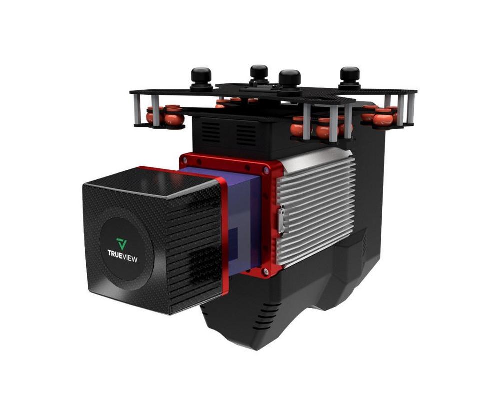
Making its European debut, LP360 and the all-new TrueView 655/660 will be exhibiting at Intergeo 2022, Europe’s largest geospatial conference. The TrueView 655/660 is GeoCue’s third generation RIEGL integration built with the miniVUX-3UAV and triple mapping cameras (right, left, nadir) for high accuracy mapping with excellent vegetation penetration and wire detection in a lightweight payload package. TrueView 3D Imaging Systems are known for their dual oblique cameras that help maximize mapping and coverage. The new TrueView 655/660 adds a third Nadir camera, allowing for imagery directly below the sensor to be captured. Frank Darmayan, CEO of GeoCue explains the added coverage of the third camera. “With our newly released 655/660…
-
GeoCue stellt auf der Intergeo 2022 erstmals die LP360 Point Cloud Software und den neuen TrueView 655/660 3D Imaging Sensor in Europa vor
LP360 und das neue TrueView 655/660 werden auf der Intergeo 2022, Europas größter Geodatenkonferenz, erstmals in Europa ausgestellt. Das TrueView 655/660 ist die dritte Generation der RIEGL-Integration von GeoCue, die mit dem miniVUX-3UAV und dreifachen Kartierungskameras (rechts, links, Nadir) für hoch präzise Kartierungen mit hervorragender Vegetationsdurchdringung und Leitungserkennung in einem leichten Nutzlastpaket ausgestattet ist. TrueView 3D Imaging Systems sind bekannt für ihre dualen Schrägkameras, die zur Maximierung der Kartierung und Abdeckung beitragen. Das neue TrueView 655/660 fügt eine dritte Nadir-Kamera hinzu, mit der Bilder direkt unter dem Sensor erfasst werden können. Frank Darmayan, CEO von GeoCue, erklärt die zusätzliche Abdeckung durch die dritte Kamera. "Bei unserer neuen Version 655/660 bietet…
-
New True View 645/650 Expands Drone Surveying Market: Riegl Lidar, Dual Mapping Cameras and DJI M300 Compatibility
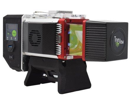
Building upon the success of its RIEGL-based True View® 3D Imaging Systems (3DIS®) GeoCue is proud to announce the new True View 645/650. GeoCue CEO Frank Darmayan explains “True View 3D imaging products provide fully integrated LIDAR sensors and photogrammetric cameras in a completely calibrated package. The newest True View 645/650 includes a Riegl mini VUX3-UAV and dual mapping cameras. It’s even lighter and more compact than previous models; that means it can be used with more drones, such as the very popular DJI M300.” He adds, “This system delivers colorized LIDAR deliverables with accuracy better than 3cm RMSE for the True View 645, and better than 2cm for the…